FIRST SEPARATE ACCOUNT OF THE ISLES OF SCILLY
A Natural and Historical Account of the Islands of Scilly; Describing their Situation, Number, Extent, Soil, Culture, Produce, Rarities, Towns, Fortifications, Trade, Manufacture, Inhabitants. Their Government, Laws, Customs, Grants, Records, and Antiquities. The Importance of those Islands to the British Trade and Navigation; the Improvements they are capable of; and Directions for all Ships to avoid the Dangers of their Rocks. Illustrated with a new and correct Draught of those Isles from an actual Survey, in the Year 1744, including the neighbouring Seas, and Sea-Coasts, next the Land's End of Cornwall. To which are added, The Tradition of a Tract of Land, called Lioness, devoured by the Sea, formerly joining those Isles and Cornwall. Of the Cause, Rise, and Disappearance of some Islands. And, lastly, A general Account of Cornwall. By Robert Heath, an Officer of his Majesty's Forces, some Time in Garrison, at Scilly.
Folding table of distances, folding plate of Upnor Castle in Kent, and folding map (early repairs to reverse of two small tears at folds).
First Edition. 8vo. [207 x 129 x 31 mm]. [1]f, viii, xvi, xiii, [i], 456 pp. Bound c.1820 in diced calf, the covers with a gilt border of a thick and thin fillet and a frond and wave roll. Smooth spine divided into six panels by gilt fillets, lettered in the second, the third and fifth tooled to a lattice pattern, the others with a central ornament, the turn-ins tooled with a gilt roll, marbled endleaves, light blue sprinkled edges. (Rebacked preserving most of the original spine).
London: printed for R. Manby and H. S. Cox, on Ludgate-Hill, 1750
Some minor spotting and a little dust-soiling but a very good copy of the first separately published account of the Isles of Scilly. Heath (d.1779) dedicated the work to the Duke of Cumberland, reminding him that the islands had been the property of his royal ancestors since the conquest of them by King Aethelstan. They may have been out of sight but were of enormous strategic importance and were calling out for attention and improvements. The map was drawn by Heath from a survey of 1744. The inclusion of a view of Upnor Castle in Kent is explained by the description of its fortifications overlooking the River Medway, and may have been an attempt by Heath to ingratiate himself with the Governor, Lieutenant General John Guise.
Stock no. ebc7785
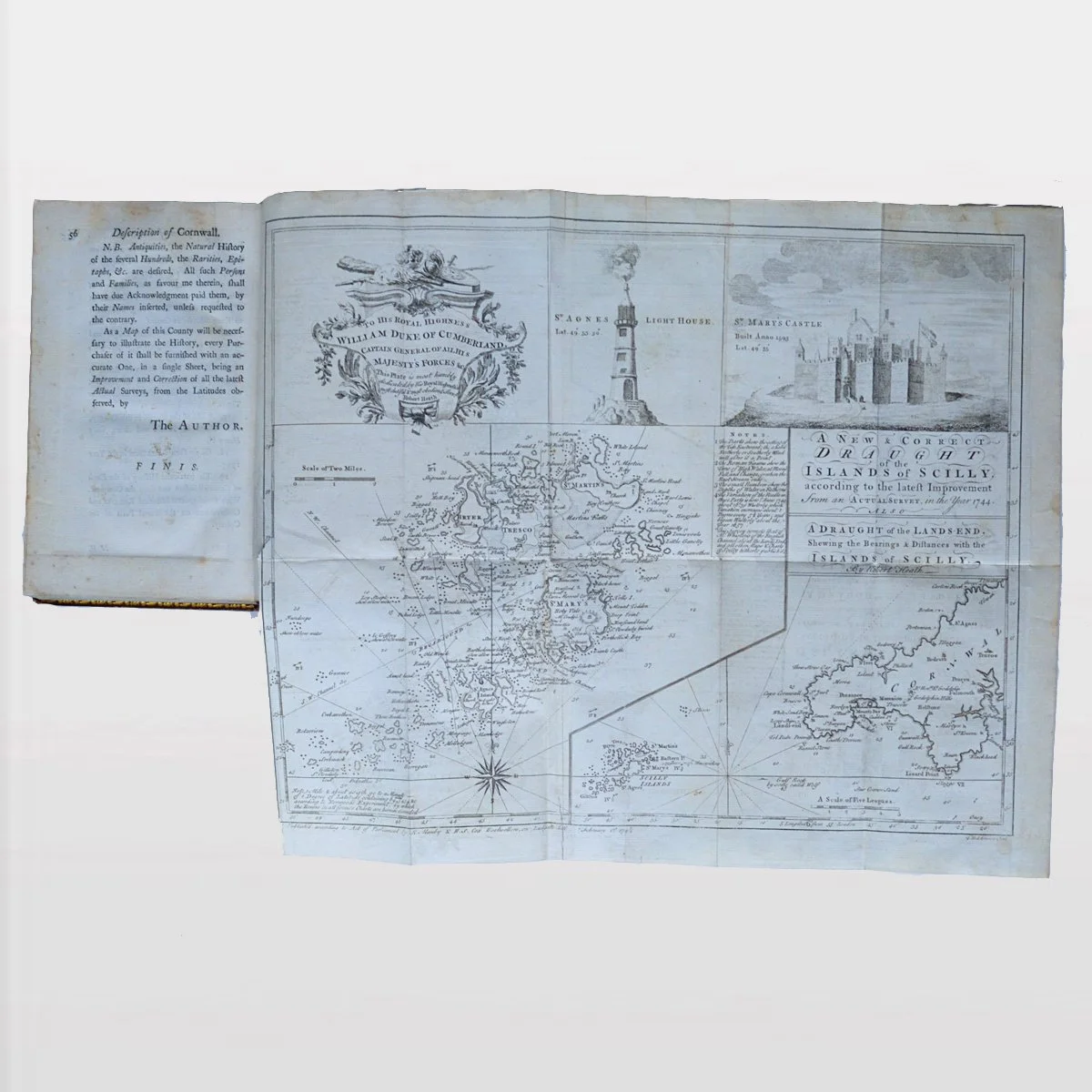 Image 1 of 1
